Maps on this page:
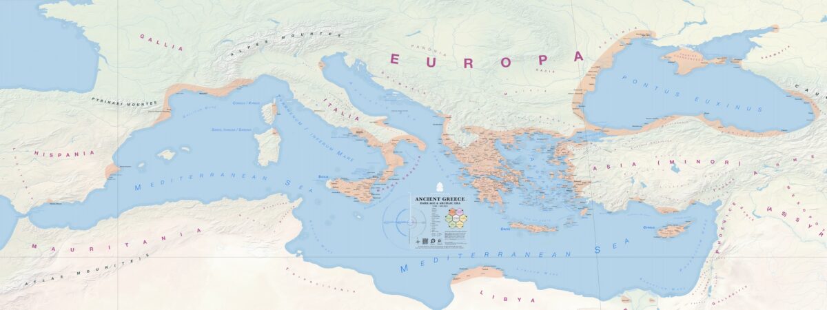
The complete Ancient Greece historical map contains over 1700 places, each hand-pinned after verification with trusted sources (list in the bibliography and the map index).
Using the maps: These exclusive maps are free for personal use and research purposes, but reproduction, remixing, embedding, or publication in any form or media is not allowed. All rights reserved.
To search, zoom, and print (research and personal use only), use your browser’s functions. The PDF files can produce high quality, poster-size prints.
Για αναζήτησή, μεγένθυση, και εκτύπωση (μόνο για έρευνα και προσωπική χρήση), χρησιμοποιήστε τα εργαλεία του προγράμματος περιήγησής σας. Τα PDF μπορούν να εκτυπωθούν σε υψηλή ποιότητα και μεγέθος αφίσας.
Updates: Older maps are replaced often with newer versions which contain bug fixes and updates. The map version number appears in the map legend after “Ancient Greece”, in the image title, and it’s the last number of the filename. The latest versions are the ones available on this page.
The Complete Map of Ancient Greece
Αναλυτικός Χάρτης της Αρχαίας Ελλάδας
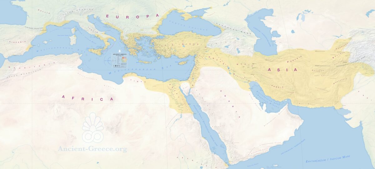
Stone Age to Roman Era: >3000 – 30 BCE
Print size: 138.89 × 62.5 inches, or 352.78 × 158.75 cm.
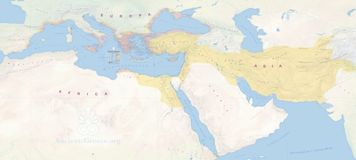
Hellenistic Era
Ελληνιστική Εποχή
323 – 30 BCE
Print size: 138.89 × 62.5 inches, or 352.78 × 158.75 cm.
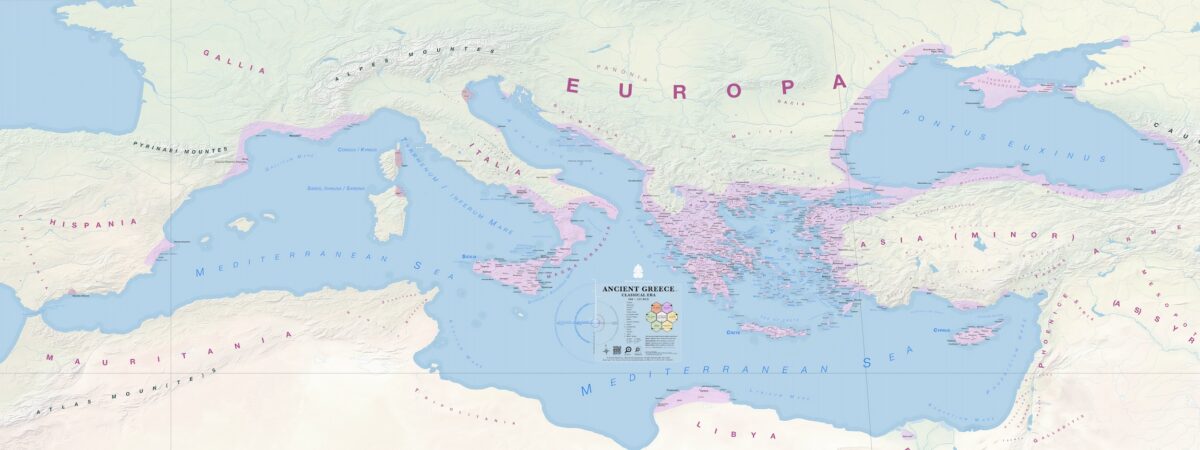
Classical Era
Κλασική Εποχή
480 – 323 BCE
Print size: 83.34 × 31.25 inches, or 211.68 × 79.37 cm.
Dark Age & Archaic Era
Σκοτεινός Αἰών & Αρχαϊκή Εποχή
1100 ~ 480 BCE
Print size: 83.34 × 31.25 inches, or 211.68 × 79.37 cm.

Stone, and Bronze Age
H Λίθινη, και h Εποχή του Χαλκού
3000 ~ 1000 BCE
Print size: 83.34 × 31.25 inches, or 211.68 × 79.37 cm.
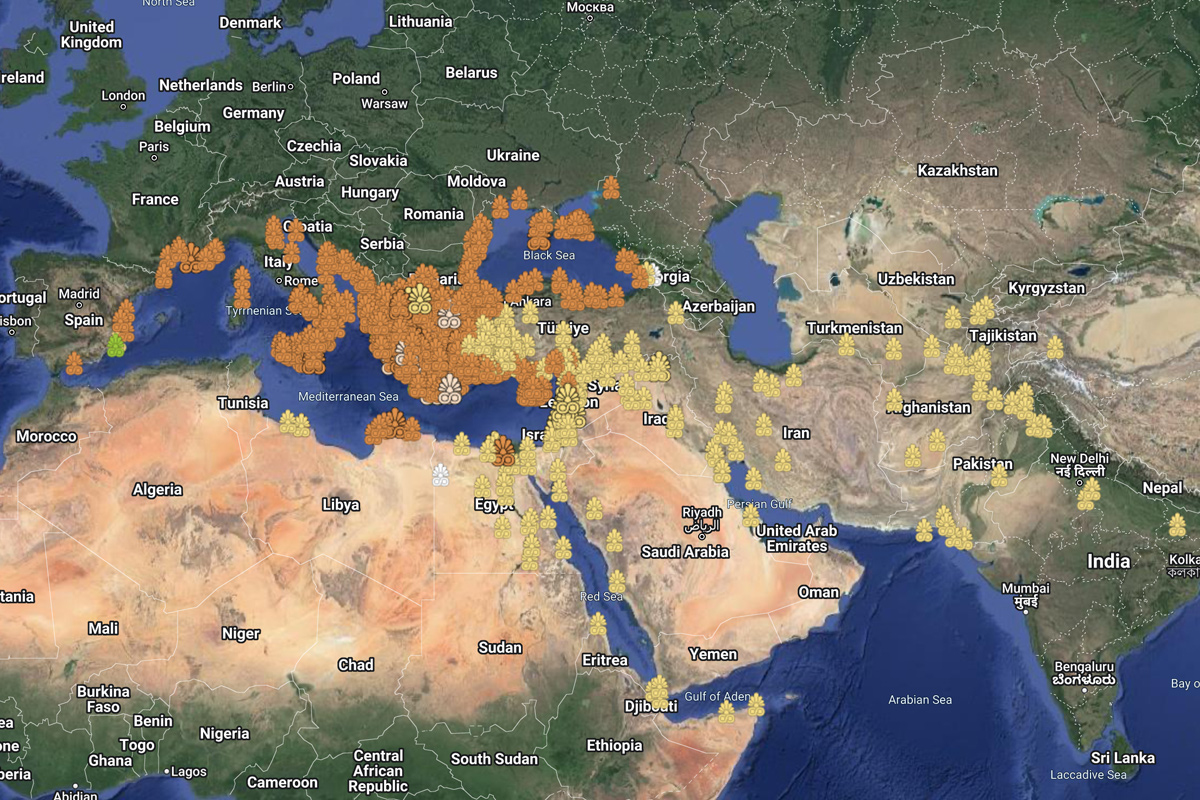
Satellite View
1000 BCE ~ 200 CE
Ancient Greece on Google Maps
Ancient Greece on Google Earth
| Multiple eras | Stone Age | Bronze Age | Dark/Archaic Age | Classical Age | Hellenistic Age | Late Hellenistic / Roman |
 |  |  |  | |  |  |
| 8000 – 3000 BCE | 3000 – 1000 BCE | 1000 – 480 BCE | 480 – 323 BCE | 323 – 146 BCE | 146BCE+ |
Archaeological site: zooming in will show an aerial view of the ancient remains.
Approximate, or General: The placemark is on the most commonly accepted location.
Probable Location: The placemark is on the most likely location based on limited information.
You will find these designations in the pop-up window after clicking on each map place.